Project Description
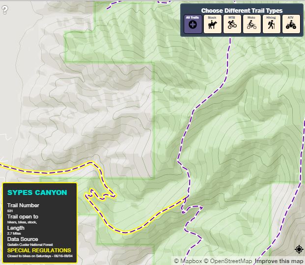
Gage Cartographics has worked extensively with recreation data across the Northern Rockies. Typical Forest Service maps are difficult to comprehend making it challenging to know where you can ride a horse, bike, snowmobile etc. After organizing trails data across several USFS regions, we built a simple map to filter trail uses and designations. The map, trailinfo.io can be seen at the link below.