Interactive maps, decision support tools, map-centric surveys, database systems, pipelines, and spatial analyses.
Services Offered
Gage Cartographics specializes in interactive maps, decision support tools, map-centric surveys, database systems, pipelines, and spatial analyses.
Interactive Mapping
Leveraging open-source mapping technologies, we develop applications that showcase intricate geospatial data and narratives.
Decision Support Tools
Building upon interactive maps, we create online tools for data insights. Users can formulate advanced queries and visualizations on datasets resulting in insights typically requiring advanced GIS analysis.
Map-Based Surveys
Harnessing maps as a foundation, I design survey tools crucial for community engagement and geospatial data gathering. These surveys enable users to share location-specific information by drawing lines, points, and polygons while adding comments to features. Traditional survey questions are seamlessly integrated, facilitating comprehensive geospatial data collection.
Databases, Piplines and Tile Services
All these tools rely on server infrastructure to host both tabular and geospatial data. My preferred platforms typically include PostGIS, TiTiler, MbTiles and other frameworks. I construct cloud-based data pipelines for processing information from diverse sources, feeding into customized databases for integration with mapping tools. Additionally, I construct tile servers for both vector and raster datasets.
Spatial Analysis
My proficiency in geographical information systems and spatial analysis underpins all these endeavors. With a background in science, I conduct analyses using Python, R, open-source tools, and traditional GIS techniques. My analyses encompass a broad spectrum, ranging from the study of migrating ungulates to continental-scale connectivity modeling, species richness analysis, and cartographic projects.
Project Examples
Find Your
Wild
Working with the Wilderness Society we develop a custom scrolling, story map to explore wild places. The tool integrates complex raster and vector datasets through open source map tiles and frameworks. Users are guided through a story and eventually get interactivity in the story modules. The users can see where the wildest places are in their selected area and also use the tool as a simple map viewer.
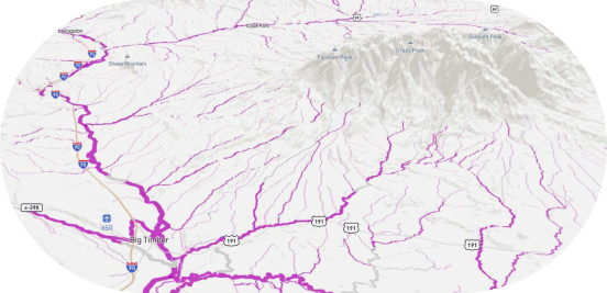
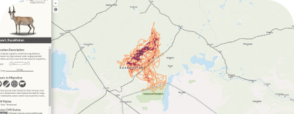
This tool built with the CMS program of the United Nations maps global Ungulate Migrations. Collaborators across the globe share spatial data on ungulate migrations which are then incorporated into the map viewer. The tool relies on open source PostGIS map tiles and complex tabular data of migration attributes.
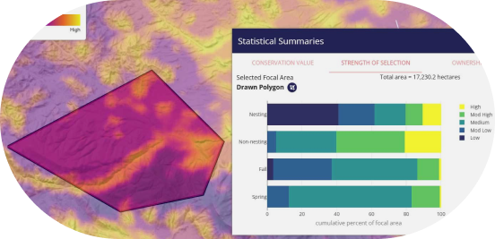
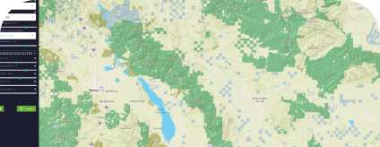
Working with Wild Montana, we created a tool to highlight important areas for conservation. Many indicator variables were analyzed and attached to vector datasets. These datasets were integrated into a decision support tool allowing users to filter by variables of interest and view results in the map and on a table.
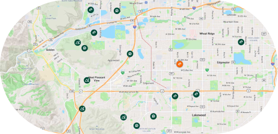
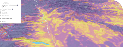
Raptor Mapper is a very complex decision support tool for learning about Golden Eagle Habitat and breeding space. We worked with the Teton Raptor Center and collaborators to display their studies in a robust mapping framework. Users can draw areas of interest and learn about habitat and breeding space.
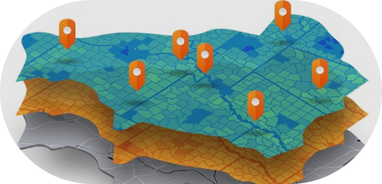
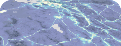
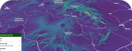
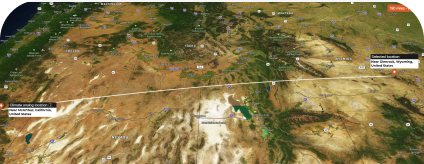
In a collaborative project with USFS and other researchers we conducted large scale connectivity analysis across the US 48 states. These models were run on AWS using Omniscape JL. Over 20 models were run with cell resolution of 90m resulting in detailed connectivity maps. A map viewer will be published in 2025 detailing the results.
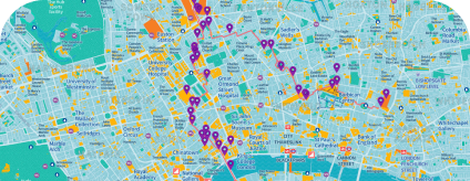
We worked with Footways London to develop a map viewer for walking routes in London. This map gives people suggested walking routes across the city along with points of interest and photos.
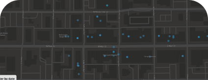
This was a pet project to explore restaurant inspection data in the city of Bozeman. We tabulated disparate data sources into an easy to use interface for exploring data relevant to restaurants across the city and county. The data is not currently dynamic and is a snapshot of available data when the project was initiated.
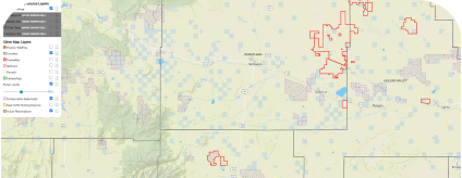
The Montana Land Source map viewer shares information about rural property sales in Montana. This tool relies on a PostGIS backend hosting many datasets on historic sales and cadastral data. Users can learn about past sale prices for properties via queries and menu selection. The tool has different tiers of data with subscribers having access to full sales histories.
In collaboration with federal and university researchers we built the +2c map viewer. This tool allows users to find how their landscape might change in the face of a changing climate. The tool relies on vector datasets and many API connections to data sources of potential climate change.